

The project
Within the framework of the European Territorial Cooperation programme 2014-2020, the Ephorate of Antiquities of the Cyclades, following an invitation from the European Centre for Byzantine and Post-Byzantine Monuments, participated in a collaboration with the Municipality of Thera in the wider programme ‘Monuments in Nature: A creative coexistence’ (Mo.Na.) with the project ‘Management of the cultural and natural heritage of the Santorini caldera’. The focus of the work within the framework of this project was the Kasteli of Skaros.
Cape Skaro
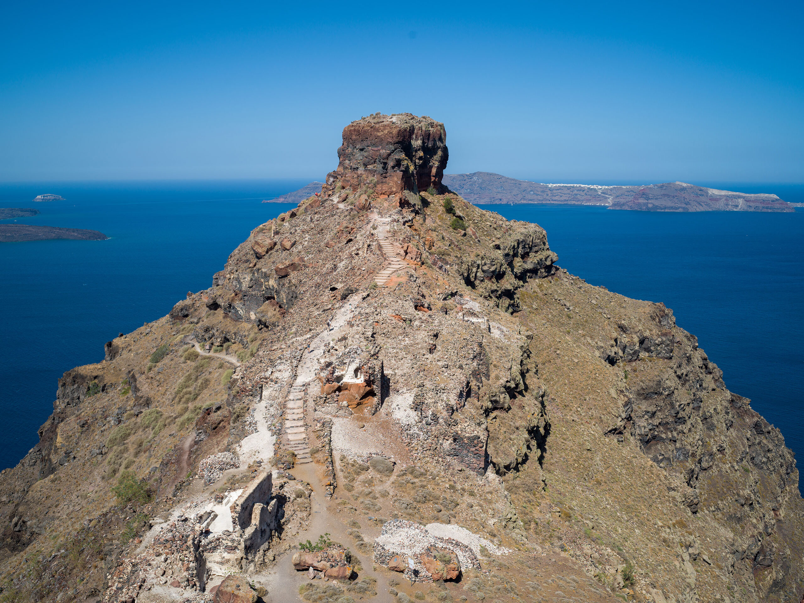
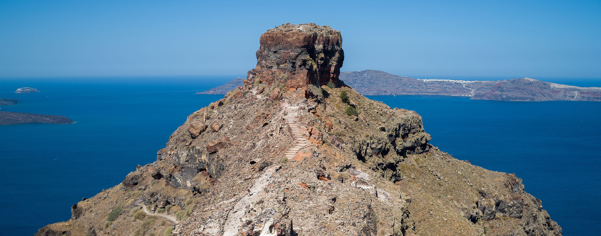
The now ruined medieval Kasteli of Skaro was built on the top of the cape of the same name that dominates the caldera bay as the most emblematic landmark on the western coast of Thera. It is at the same time the most important archaeological site of the caldera coastline: here the monument combines most harmoniously with the unique volcanic landscape.
An inscription, cut into a rock and dating from approximately the second half of the 5th century BC, marked the boundary of a sanctuary dedicated to Athena. The inscription, as well as several references to other antiquities in the area – given too the advantageous, natural fortified position of Skaro, all indicate the existence of settlement on this cape since antiquity. The name ‘Scharo’ is mentioned for the first time in 1485, by the traveller Bartolomeo da li Sonetti. The process of unravelling the enigmatic complexity of the ruined structures involved in the Mo.Na project has also provided us with evidence of the habitation of Skaros during the Early Middle Ages and the Early Byzantine periods. This too strengthens the already strong indication of its continuous use from antiquity until the foundation of the Venetian castle.
The Medieval Castle of Skaros
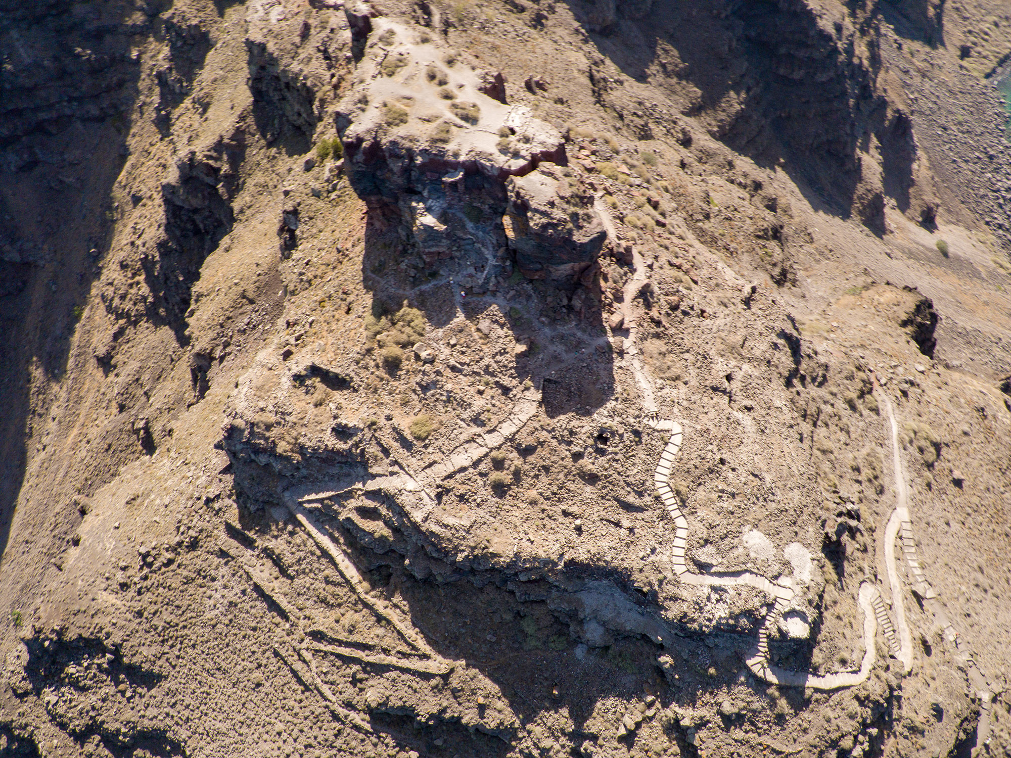
The Castle of Skaros, built on this naturally fortified site in the 13th century by the Barrocci family (1207–1265), was the first Venetian capital of Thera. The densely-populated fortified settlement consists of the Upper Castle/Epano Kastro or acropolis, known as the ‘Rocca’, which was the first residential core, and the Lower Castle/Kato Kastro, around the foot of the rock. Relevant sources state that the ‘Rocca’ suffered serious damage during the volcanic eruption in 1650 and its inhabitants gradually moved to Kato Kastro. Major volcanic eruptions of the 18th (1707-1711) and 19th centuries (1866-1870) forced its inhabitants to abandon Skaros and settle in the modern capital of the island, Fira. The drawing by the French consul L.S. Fauvel (Thomas Hope Collection at the Benaki Museum) (fig. 1) is a valuable and accurate depiction of the Kastelio of Skaros at the end of the 18th century and provided the starting point for the ‘on-the-spot’ exploration of its ruins.
Kasteli was fortified with a defensive wall reinforced with towers that enclosed many houses and churches (fig. 1) Its entrance was located in the east, where even today can be seen the towers of rectangular plan that reinforce the eastern wall of the settlement. The tower in the centre of the eastern side, together with a drawbridge, protected the main gate of the Castle (fig. 1a-02, fig. 2). It follows the typical layout of the area for the period. The towers and the defensive wall were in fact the outward-facing sides of the houses of the town proper. Ceramic finds from the tower date it from the 15th to the 19th centuries.
On the west side of Kastro, a cylindrical tower was investigated (fig. 1b-05), the excavation of which revealed findings from the 13th to the 20th centuries. As can be seen from its masonry, it was constantly undergoing repairs in its role of protecting the western face of the defensive wall. Test sections inside the wall revealed a series of spaces arranged perpendicular to it (casements).
The continuous collapses of the volcanic rock as well as that of all the structures had covered the ruins of the fortified city with debris. During the work of cleaning, dozens of buildings were identified within the walls of Skaros (fig. 1), as their basements or ground floors came to light. Some were domed structures cut into the soft volcanic soil, while others were built of stone.
However, it proved impossible to carry out the research across all of Kasteli, nor to effect any restoration work without risk, due to the extensive layers of destruction, combined with the extremely steep terrain. One of these impractical places was the northern side of Kato Kastro, where according to Fauvel’s plan there were two churches, probably Panagia Maroulas and Agia Irini (fig. 1-08, fig. 2).
Agia Theodosia – Panagia Xeportiani
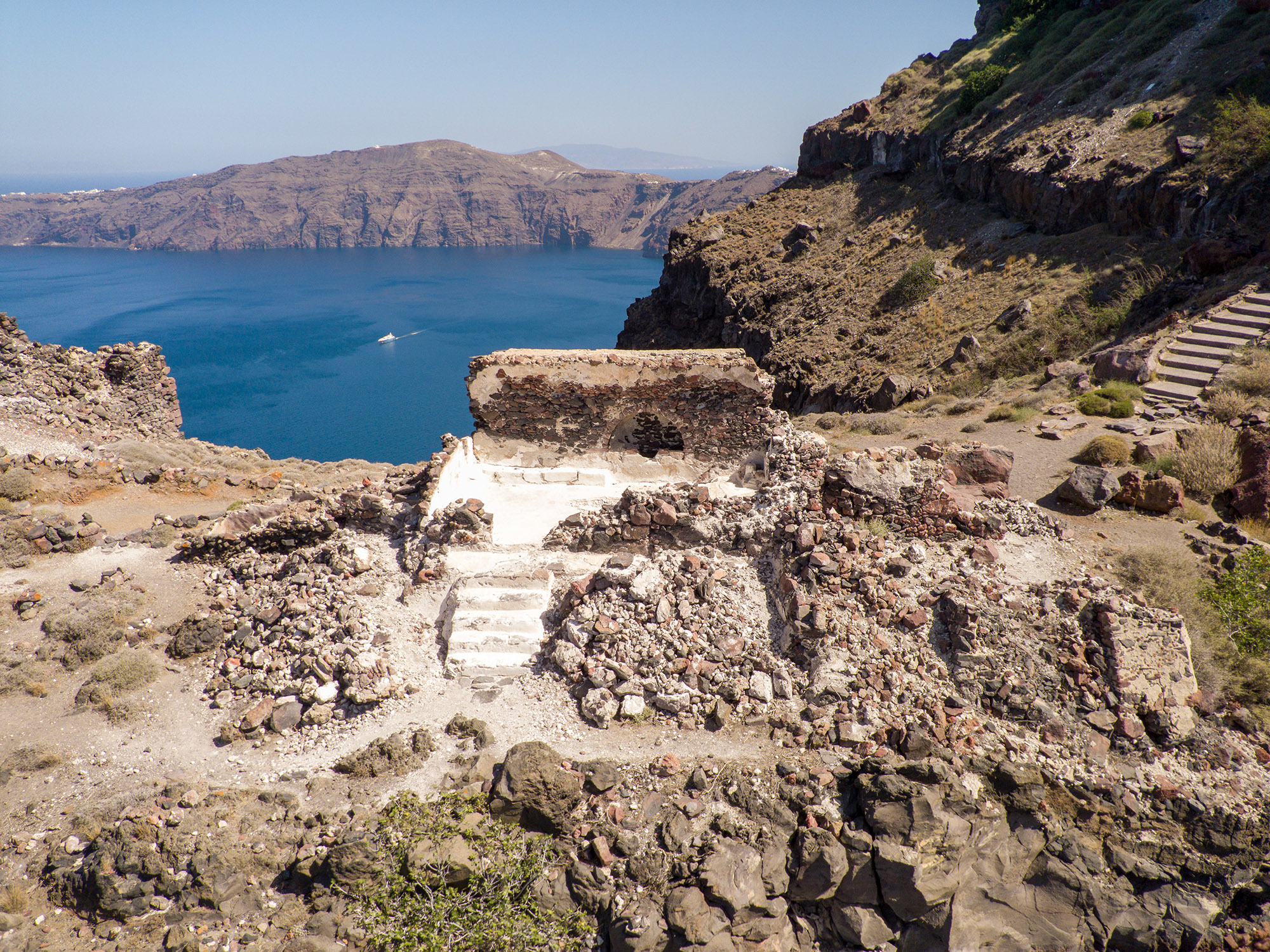
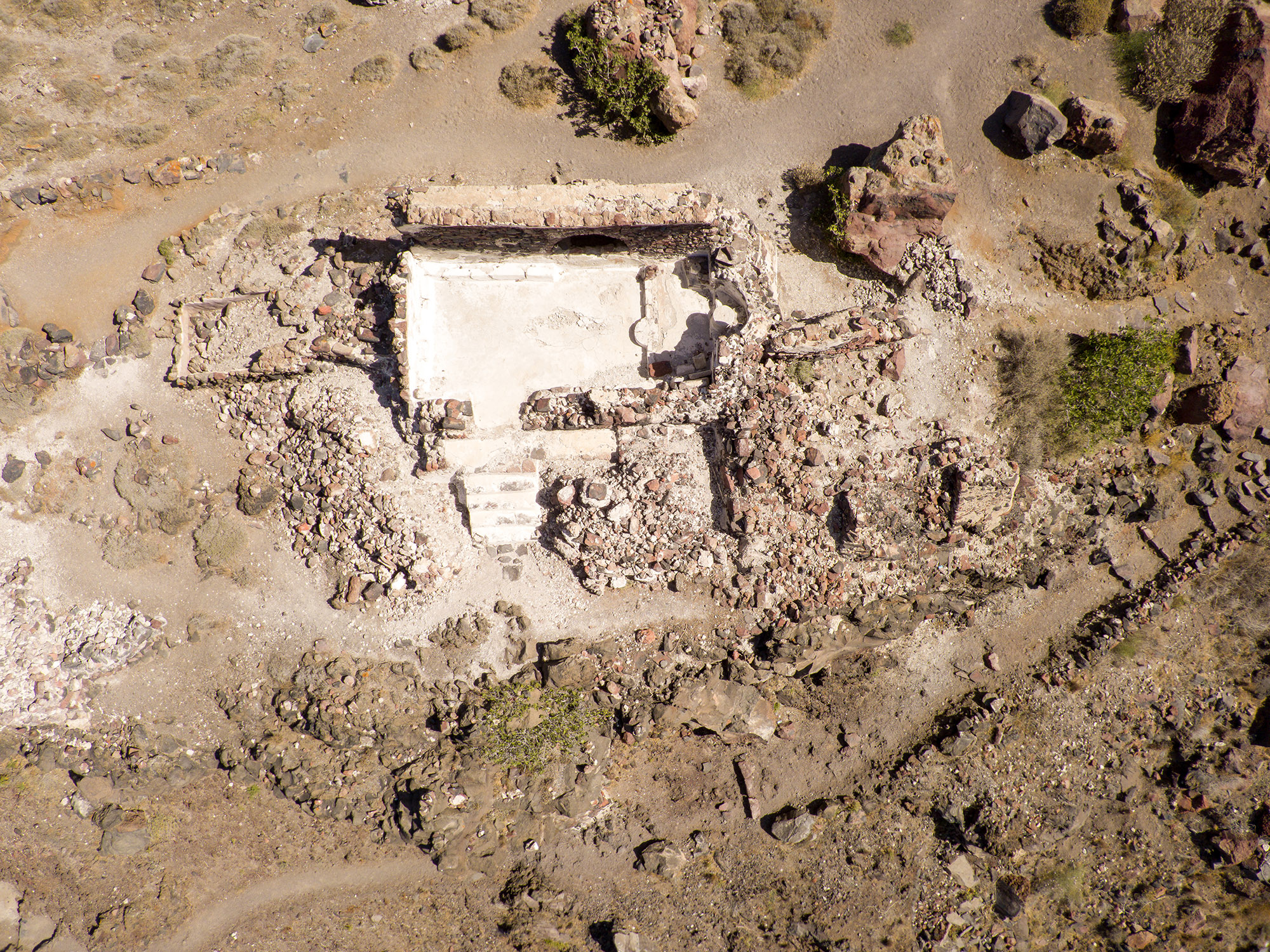
Investigation was also extended outside Kasteli to the complex of the two ruined churches of Agia Theodosia, the patroness of Kasteli, and of Panagia Xeportiani, in front of the castle gate (fig. 3). The cleaning revealed the oldest of the two vaulted single-roomed churches, (fig. 1-01) to be Agia Theodosia. Among the most important finds were an ancient funerary stele put to a second use with the Venetian coat of arms of Crispi engraved on it, and probably set above the lintel of the entrance, an unknown funerary inscription from a Roman tomb identified as being reused as a base for the Holy Altar, and finally an arcosolium with two burials in the north wall, dated by the ceramic finds to the 17th-18th centuries.